Latest Post
Showing posts with label Petroleum and Structural Geology. Show all posts

Diastrophism


Diastrophism

diastrophism, also called tectonism, large-scale deformation of Earth’s crust by natural processes, which leads to the formation of continents and ocean basins, mountain systems, plateaus, rift valleys, and other features by mechanisms such as lithospheric plate movement (that is, plate tectonics), volcanic loading, or folding.

The study of diastrophism encompasses the varying responses of the crust to tectonic stresses. These responses include linear or torsional horizontal movements (such as continental drift) and vertical subsidence and uplift of the lithosphere (strain) in response to natural stresses on Earth’s surface such as the weight of mountains, lakes, and glaciers. Subsurface conditions also cause subsidence or uplift, known as epeirogeny, over large areas of Earth’s surface without deforming rock strata. Such changes include the thickening of the lithosphere by overthrusting, changes in rock density of the lithosphere caused by metamorphism or thermal expansion and contraction, increases in the volume of the asthenosphere (part of the upper mantle supporting the lithosphere) caused by hydration of olivine, and orogenic, or mountain-building, movements.

Orogenic
it is marked by deformation of the earth's crust ,including radial and slow deformation. orogeny, mountain-building event, generally one that occurs in geosynclinal areas. In contrast to epeirogeny, an orogeny tends to occur during a relatively short time in linear belts and results in intensive deformation. Orogeny is usually accompanied by folding and faulting of strata, development of angular unconformities (interruptions in the normal deposition of sedimentary rock), and the deposition of clastic wedges of sediments in areas adjacent to the orogenic belt. Regional metamorphism and magmatic activity are often associated with an orogenic event as well. Orogenies may result from subduction, terrane accretion (landmass expansion due to its collision with other landmasses.

This diagram depicts some common fold types


Fault Types


Epeirogenic regional up lift of the crust which result in large scale deformation .

-involves vertical movement of crust .
-not involves severe deformation of the crust .
-causes submergence of cratons by several thousand of meters

Epeirogenic movement can be permanent or transient. Transient uplift can occur over a thermal anomaly due to convecting anomalously hot mantle, and disappears when convection wanes. Permanent uplift can occur when igneous material is injected into the crust, and circular or elliptical structural uplift (that is, without folding) over a large radius (tens to thousands of km) is one characteristic of a mantle plume.

Epeirogenic movement has caused the southern Rocky Mountain region to be uplifted from 1300 to 2000 m since the Eocene.This followed and is distinct from the creation of the Rocky Mountains during the Laramide Orogeny during the Late Cretaceous–early Cenozoic. The uplift is interpreted as due to lithospheric heating resulting from thinning and the intrusion of widespread middle Tertiary batholiths of relatively low density.

In contrast to epeirogenic movement, orogenic movement is a more complicated deformation of the Earth's crust, associated with crustal thickening, notably associated with the convergence of tectonic plates. Such plate convergence forms orogenic belts that are characterized by “the folding and faulting of layers of rock, by the intrusion of magma, and by volcanism


RELIEF FEATURES


RELIEF FEATURES

Various type of landform of the Earth’s crust classified under three orders of magnitude:

The first order comprises continents and Oceans which are the largest features on the Earth. The configurations of continents & ocean basins haven't remain static such as sea floor spreading and faults. Many ancient features have understandably dissolved in the mists of time. However, geoscientists have pieced together evidences which show that parts of the earth’s crust had been elevated and depressed, extensive stretched of dry lands of the present day were under water, violent episodes of volcanic activity and impact of extra-terrestrial bodies has scared the earth’s face and mountain ranges had been heaved up and worn down.

The second order comprises mountains and plains which have resulted by the action of the internal forces of the earth. Such action of forces emanating from deep within the bowels of the earth includes both orogenic and epeirogenic movements.

The third order features result by the action destructional force and give rise to residual features of peaks, erosional features including valleys and canyons and depositional features like deltas. Also, weathering, streams, waves, wind and glaciers produce relief features of the third order.

First order landforms:

The slope element of the Earth:

-deep sea platform of the ocean

- Continental slope

- Continental shelf

- Continental platform 


The earth's surface is inhomogeneous:

1. 70.8 % of the earth's surface are under water.

2. 29.2 % of the land continents

3. Land and sea are mostly antipodal arranged. Only1.5 % of the surface has land antipodal to land.

4. About two-third of land is in northern hemisphere

5. The deepest parts of oceans aren't always far out from the land and are often located clothe to mountain ranges as in Island arcs

Major topographic element:

1- Ocean ridges:

Wide oceans has brought to light traversal fractured linear ridges extending over a distance of about 64000 K m with width of 2000-4000 Km and rise from 1-3 Km from the ocean floor.

Examples:

The Atlantic & Indian ocean are irregular.
The east pacific ridge is smooth arch.
The mide Atlantic ridge is characterized by 25 – 50 Km wide axial rift valleys.

The Carlsberg ridge is a branch of Indian ocean ridge, branches off towards the north, enters the Gulf of Aden and thence the red sea.
Southerly branch runs through the rift valley system of East Africa.
The East pacific ridge isn't marked by central rift valleys; it’s bordered by faulted steps, ridges & troughs.
Ridges are tectonically unstable marked by shallow earthquakes, high heat flow & volcanic activity

2-Ocean basins:

The ocean basins flanking the mid – ocean ridges are abyssal plains which characterized by hills and sea mounts.
The abyssal plains are tectonically inactive and have gentle gradients of less than 1:1000.They are known to be up to 1000 Km in width below water columns measuring 3-6 Km in depth. They are found to increase in thickness toward the continental slope and shelf.
The sea mount in the bed are spectacular features with width 2-100 Km and rising to dizzy heights of more than 1000 m from the abyssal plain
Sea mounts have sharply pointed and flat tops and they are in the form of hills whose tops are in some cases below a water column of 200 meters.
Guyots: are steep-sided seamounts (12o- 35o) appearing to have ware leved platforms whose submergence is attributed to sea-floor subsidence and rise in water level in post –glacial time.

Continental slope and rise:

The present shoreline of ocean does not limit the extent of continental rocks. The outer edge of the continental shelf, approximately located 0.135 kilometers below the sea level delimits the continental rock.

Continental slope is the part leads into the deep sea, from its outer edge descends at slope up to 6o to depth of two kilometers. Continental sediments in the form of coalescing fans and aprons mark the base of continental slope. In seaward extension of large rivers, submarine canyons mark the continental shelf and slope.

Continental rise is a wide, gentle incline from an ocean basin to a continental slope. A continental rise consists mainly of silts, muds, and sand, and can be several hundreds of miles wide. Although it usually has a smooth surface, it is sometimes crosscut by submarine canyons.

3 - Ocean Trenches, deeps or troughs:
Oceans trenches define the deepest parts of ocean floor. They are known to be variable in length (300 – 5000 Km) and 30 – 100 Km in width, with slopes of 10o – 16o in their deeper parts. The trenches run parallel to island arcs or younger volcanic zones on their seaward side.

4- Island Arcs:

Most ocean trenches on their landward side are marked by parallel accurate festoons of islands. In certain cases, they are topographically and structurally continuous with continental belts of young folded mountains. They are tectonically active zones with profound seismicity.

5- Marginal Sea Basins:

They occur between island arcs and continents. Some of them are 500 to 1000 Km wide and have rugged bottoms with faults, undulations and small sea-mounts characterizing complex histories and different sediment sources. Both tectonically active and inactive basins are known

6- Folded Mountains

It is formed in sediments under the impact of compression. Folding, thrusting and uplift are thrown up as curvilinear mountain chains which may be associated with volcanic activity, deep igneous emplacement and metamorphism.
Broadly, folded mountains may be divided into older and younger groups. The older groups have medium scale elevations and are tectonically more stable than younger group. The younger groups include mountains of highest terrestrial elevations like ALPS and Himalayas.


Basic concepts and significance of geomorphology


Basic concepts and significance of geomorphology
Geomorphology means a discourse on earth forms. The Geomorphological studies encompass landforms of the continents, their margins and the sea floor.

Landforms are studied from three different points of view:

‐The geologist looks into the geological controls in the evolution of landforms. In the study of landforms by geologists, understanding the historical and dynamic elements of the process that change the geological materials and structure is very important.
‐The geographer concerns with the adjustment of human activities in charging landforms.
‐The engineer assesses the terrain from the point of view of engineering construction and availability of materials for construction.


Sources and time of geomorphological activities:

All geological and geomorphological activities of the earth are due to endogenetic and exogenetic sources of energy. Example of endogenitic sources is the convection currents in the mantel that may produce earthquake, volcanoes and plate movements. Exogenetic sources may be represented by the solar radiation,
gravitational attraction and biological processes.

Landform units are studied not only with the reference to their magnitude, but also to the time it is taken to be formed. The time of the evoluti

on of geomorphological landforms ranges from few minutes (ex. Ripple marks) to long period of millions of years (ex. Mountainous chains).


Concepts of geomorphology


During the fifteens and sixteen evolution of landforms was based on the philosophy of catastrophism until James Hutton (1726 – 1797) has changed it to scientific though with his principle of uniformitarianism. This leads to the

main concepts of geomorphology which are as follows:

First concept depends on the principle of uniformitarianism that conveys that the present is the key of the past. James Hutton applied this principle rigidly and stated that geological processes have been active at the same level of intensity throughout the geological time. IT IS NOW RECOGNISED THAT IT IS NOT TRUEthat the physical processes and laws which are in operation during the present time were active in the geological past, but notnecessarily with the same intensity as now.

Second concept: that in the evaluation of landforms, structure such as joint, folds, fault and permeability plays a crucial role and is reflected in the landforms. Geomorphic features developed on rocks are in general much younger to the structural features of the rocks.

Third concept is that geomorphic process operates not on a uniform rate but at differential rates resulting in the evolution of relief features. The processes are affected by many factors as altitude, temperature, moisture, type of vegetation and microclimatic condition.

Fourth concept that geomorphic processes produce distinctive imprints on landforms and characteristic assemblage of landforms evolve as a result to the operation of different geomorphic processes. For example, deltas and alluvial fans result by stream action where caves in limestone terrain are attributed to ground water

Fifth concept states that according to W. Davis (1850‐1934) thought that landforms display distinctive characteristic depending on the stage of their development. So that the evolution of landforms is through youth, maturity and old age stages. Though many geomorphologiste are not convinced of this
concept, because an orderly sequence of landforms come into being by the action of different erosional agents on the earth’s surface.

Sixth concept is that geomorphic evolution is one of complexity then simplicity. In one geomorphic process or cycle, remnants of landforms not related to the current cycle of erosion are recognized. Five categories of landforms including simple, compound, monocyclic, multicyclic and exhumed have been recognized.
 

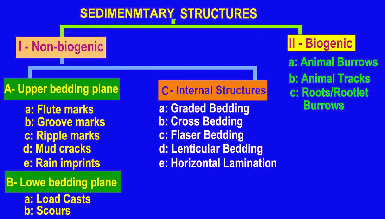
Secondary Sedimentary Structures

Secondary Sedimentary Structures

Bedding plane structures
Another class of sedimentary structures form on the interface between beds, usually on the exposed surface of a recently deposited bed before it is buried. These features are useful because they indicate current direction and post-depositional deformation of the sediment.
Sole marks are formed by currents acting on sediment.
  • Flute casts: Elongate teardrop shaped depressions that taper upstream. Caused by the scouring action of turbulent flow, common in turbidity currents.
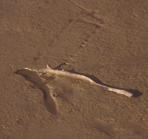
  • Tool mark: Indention of the cohesive mud bottom by a "tool," and object dragged across sediment by current (right).

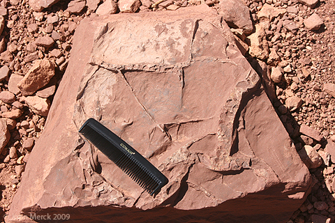
Mud cracks Indicate subaerial exposure. Recent 
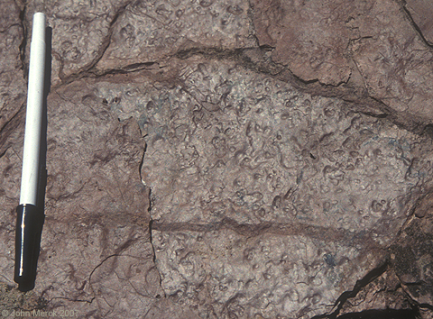
Rain drop prints 
Geopetal structures indicate the top of beds, and these can be found as:
  • Scoured tops of ripple crests yielding truncated cross-bedding. (Recent.) (Ancient.)
  • Graded bedding
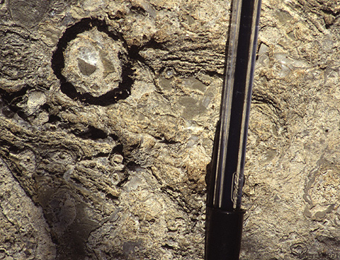
  • Infilling of fossils or vugs (right).
  • sole marks

Soft Sediment Deformation
Soft sediment deformation structures result from movement of sediment after deposition but prior to cementation. Sometimes this is due to the application of some sort of external load (e.g. soft sediment faulting) but are usually due to a density instability between different sediments layers. The most common are load structures, irregular bulbous features formed when a denser material has sunk into a less dense material (right). In some cases, denser material pinches off to form pseudonodules (a.k.a. ball and pillow structures). 
Tongue like protuberances of mud into overlying soft sediment are known as flame structures
Finally, deformation of soft sediment leads to convolute bedding, suggesting intense structural deformation.
 

SEDIMENTARY STRUCTURES OF CLASTIC


Sedimentary structures are those large features recorded in the field along the bedding surfaces or within the sediment-body, formed during deposition before consolidation.


Sedimentary structures
Sedimentary structures: Macroscopic three-dimensional features of sedimentary rocks recording processes occurring during deposition or between deposition and lithification. They are probably the most critical means of interpreting sedimentary and post-depositional processes. Their recognition and application are key to defining depositional environments, geological history, and surface processes.

Sedimentary structures function as:
Geopetal structures: indicators of original verticality
Directional structures: indicators of current direction
Identifiers of the agent of transport.

Types of Sedimentary Structures: We recognize two principle types:
Primary sedimentary structures: occur in clastic sediments and produced by the same processes (currents, etc.) that caused deposition. Includes plane bedding and cross-bedding.
Secondary sedimentary structures: are caused by post-depositional processes, including biogenic, chemical, and mechanical disruption of sediment.

As sedimentologists, we care about sedimentary structures because of their wealth of information about the environment of deposition. We will focus on primary sedimentary structures in this lecture; later, we'll go into depth about some chemical and biological structures.


Primary Sedimentary Structures

Plane bedding

Bedding forms as a direct consequence of Steno's law of lateral continuity, that holds that a unit of sediment will extend laterally to the physical margins of the basin it is filing:

"Material forming any stratum were continuous over the surface of the Earth unless some other solid bodies stood in the way."

We perceive plane beds because of changes in the composition or grain size of sediment during deposition. This, in turn, reflects changing rates of deposition. Three basic mechanisms can form plane bedding:
Sedimentation from suspension
Horizontal accretion from a moving bedload
Encroachment into the lee of an obstacle.

Our perception of bedding is a function of scale. At the largest scale, successions of undisturbed formations may appear as superposed beds, however at finer scales, these resolve into other sedimentary structures that may not be strictly planar.


When bedding persists at fine scale (< 1cm) is called lamination.

In what depositional environment would one most likely expect to find plane bed laminations?
One possibility
Another

Factors might disrupt fine scale laminations in mudrocks include:
Flocculation of clays - clumping before particles settle
Bioturbation - disturbance by organisms (right)
 

Playa

Playa, ( Spanish: shore or beach) , also called pan, flat, or dry lake,  flat-bottom depression found in interior desert basins and adjacent to coasts within arid and semiarid regions, periodically covered by water that slowly filtrates into the ground water system or evaporates into the atmosphere, causing the deposition of salt, sand, and mud along the bottom and around the edges of the depression.

Playas are among the flattest known landforms. Their slopes are generally less than 0.2 metre per kilometre. When filled with only a few centimetres of water, many kilometres of surface may be inundated. It is the process of inundation that develops and maintains the near-perfect flatness so characteristic of these arid-region landforms.

Playas occupy the flat central basins of desert plains. They require interior drainage to a zone where evaporation greatly exceeds inflow. When flooded, a playa lake forms where fine-grained sediment and salts concentrate. Terminology is quite confused for playas because of many local names. A saline playa may be called a salt flat, salt marsh, salada, salar, salt pan, alkali flat, or salina. A salt-free playa may be termed a clay pan, hardpan, dry lake bed, or alkali flat. In Australia and South Africa small playas are generally referred to as pans. The low-relief plains of these lands contrast with the mountainous deserts of North America, resulting in numerous small pans instead of immense playas. The terms takyr, sabkha, and kavir are applied in Central Asia, Saudi Arabia, and Iran, respectively.

Saline flats are specialized forms located adjacent to large bodies of water, as, for example, along coasts, lakeshores, and deltas. They flood during storms, either with surface runoff or with surges from the nearby body of water. The saline crusts of saline flats are quite similar to those that develop in playas.

Role of flooding and groundwater

Playas affected by occasional surface floods are usually dry. Their surfaces consist of silt and clay deposited by the floodwaters that enter closed basins during the occasional flow events. Salts develop as ponded floodwater in the centre of such a basin gradually evaporates. Water also can be supplied to closed basins by groundwater flow. In basins dominated by groundwater inputs, sediment influxes are minimized, and saline crusts dominate. Moist areas may persist as groundwater flows to the lowest portion of playas. Very large playas may exhibit dry, sediment-dominated sections and moist, salt-dominated sections.

Physical characteristics

Enclosed basins of salt and clay accumulation may originate from numerous causes. Tectonic causes include faulting, as in the East African Rift Valley and Death Valley, and warping, as in Lake Eyre in Australia, Lake Chad in central Africa, and Shaṭṭ al-Jarīd (Chott Djerid) in Tunisia. Wind deflation can produce shallow basins with downwind dunes, as in southeastern Australia. Even very large basins, such as the Qattara Depression of Egypt, have been ascribed to deflation. Local cataclysmic disruptions of drainage (e.g., volcanism, landslides, and meteorite impacts) may produce playas in desert regions.

Modern playa surfaces are not passive receptors of sediment as they were once believed to be. They serve as important sources of dust and salts, which are blown to the surrounding uplands. Complex assemblages of minerals and sediments occur on the playa surfaces. These directly reflect their environment of deposition and may be used to interpret ancient environmental conditions.

Two broad classes of playas may be defined on the basis of past histories. One type develops from the desiccation of a former lake. Sediments in such a playa are primarily lacustrine, rather than derived from modern depositional processes. The second type of playa has no paleolacustrine heritage. Small salt pans in South Africa, called vokils, are of this type.

The supply of material, basin depth, and duration of accumulation all contribute to variations in the thickness of playa deposits. Very thick playa sequences may have alternating layers of lacustrine clays and salt beds. The former generally reflect periods of high floodwater runoff into the closed basins, perhaps induced by higher rainfall (so-called pluvial periods). Saline sediments or pure evaporite beds reflect arid climatic phases. The precise climatic interpretation of paleolacustrine playa sequences, however, can be problematic.


Read more : http://www.geologypage.com/2013/07/playa.html#ixzz2mXc8vQgO 


WEATHERING AND SOIL FORMATION

   WEATHERING AND SOIL FORMATION

SOIL FORMATION
WEATHERING PROCESSES


Weathering is the physical or chemical breakdown of rock. It is this process by which rock is converted into soil. Weathering is generally thought of as a variety of physical or chemical processes that are dependent on theenvironmental conditions present.

(i) Physical Processes


Physical weathering occurs when rocks are broken in to smaller pieces without changing the chemical composition of the rock. Think of a physical change (e.g., ripping a piece of paper) where the sample will change in size but all its other characteristics will remain the same. Physical weathering is the disintegration of rock. Physical weathering processes break rock masses into smaller and smaller pieces without altering the chemical composition of the pieces. Therefore, the disintegrated fragments of rock exhibit the same physical properties as their sources. There are a few types of physical weathering such as:

· Unloading.
· Frost action.
· Organism growth.
· Temperature changes.
· Crystal growth.
· Abrasion.


Petroleum System

Petroleum System

The Petroleum System consists of a mature source rockmigration pathway ,reservoir rocktrap and seal. Appropriate relative timing of formation of these elements and the processes of generation, migration and accumulation are necessary for hydrocarbons to accumulate and be preserved.
The components and critical timing relationships of a petroleum system can be displayed in a chart that shows geologic time along the horizontal axis and the petroleum system elements along the vertical axis.
Exploration plays and prospects are typically developed in basins or regions in which a complete petroleum system has some likelihood of existing. 


 Source Rock Hydrocarbon Generation
 
The formation of hydrocarbon liquids from an organic rich source rock with kerogen and bitumen to accumulates as oil or gas.
Generation depends on three main factors:
  • the presence of organic matter rich enough to yield hydrocarbons,
  •  adequate temperature,
  • and sufficient time to bring the source rock to maturity.
  • Pressure and the presence of bacteria and catalysts also affect generation.
  • Generation is a critical phase in the development of a petroleum system.

Migration
The movement of hydrocarbons from their source into reservoir rocks.
  • The movement of newly generated hydrocarbons out of their source rock is primary migration, also called expulsion.
  • The further movement of the hydrocarbons into reservoir rock in a hydrocarbon trap or other area of accumulation is secondary migration.
  • Migration typically occurs from a structurally low area to a higher area in the subsurface because of the relative buoyancy of hydrocarbons in comparison to the surrounding rock.
  • Migration can be local or can occur along distances of hundreds of kilometres in large sedimentary basins, and is
  • critical to the formation of a viable petroleum system.

Accumulation

The phase in the development of a petroleum system during which hydrocarbons migrate into and remain trapped in a reservoir.

Reservoir

A subsurface body of rock having sufficient porosity and permeability to store and transmit fluids.
  • Sedimentary rocks are the most common reservoir rocks because they have more porosity than most igneous and metamorphic rocks and
  • they form under temperature conditions at which hydrocarbons can be preserved.
  • A reservoir is a critical component of a complete petroleum system.

Seal (cap rock)

An impermeable rock that acts as a barrier to further migration of hydrocarbon liquids.
Rocks that forms a barrier or cap above and around reservoir rock  forming a trap such that fluids cannot migrate beyond the reservoir. The permeability of a seal capable of retaining fluids through geologic time is   ~  10-6 to 10-8 darcies.  commonly
  • shale, mudstone
  • anhydrite 
  • salt, 
  • A seal is a critical component of a complete petroleum system.

Trap

A configuration of rocks suitable for containing hydrocarbons and sealed by a relatively impermeable formation through which hydrocarbons will not migrate.
Traps are described as

  • structural traps
    • Hydrocarbon traps that form in geologic structures such as folds and faults


  • stratigraphic traps
    • Hydrocarbon traps that result from changes in rock type or pinch-outs, unconformities, or other sedimentary features such as reefs or buildups.
  • A trap is an essential component of a petroleum system.


Plate Boundaries

Plate boundaries
Scientists now have a fairly good understanding of how the plates move and how such movements relate to earthquake activity. Most movement occurs along narrow zones between plates where the results of plate-tectonic forces are most evident.


There are four types of plate boundaries: 


·         Divergent boundaries -- where new crust is generated as the plates pull away from each other.

·         Convergent boundaries -- where crust is destroyed as one plate dives under another.


·         Transform boundaries -- where crust is neither produced nor destroyed as the plates slide horizontally past each other.

·         Plate boundary zones -- broad belts in which boundaries are not well defined and the effects of plate interaction are unclear.

1- Divergent boundaries occur along spreading centers where plates are moving apart and new crust is created by magma pushing up from the mantle. Picture two giant conveyor belts, facing each other but slowly moving in opposite directions as they transport newly formed oceanic crust away from the ridge crest. 
                                         

Perhaps the best known of the divergent boundaries is the Mid-Atlantic Ridge. This submerged mountain range, which extends from the Arctic Ocean to beyond the southern tip of Africa, is but one segment of the global mid-ocean ridge system that encircles the Earth. The rate of spreading along the Mid-Atlantic Ridge averages about 2.5 centimeters per year (cm/yr), or 25 km in a million years. This rate may seem slow by human standards, but because this process has been going on for millions of years, it has resulted in plate movement of thousands of kilometers. Seafloor spreading over the past 100 to 200 million years has caused the Atlantic Ocean to grow from a tiny inlet of water between the continents of Europe, Africa, and the Americas into the vast ocean that exists today.


2.Convergent boundaries

The size of the Earth has not changed significantly during the past 600 million years, and very likely not since shortly after its formation 4.6 billion years ago. The Earth's unchanging size implies that the crust must be destroyed at about the same rate as it is being created, as Harry Hess surmised. Such destruction (recycling) of crust takes place along convergent boundaries where plates are moving toward each other, and sometimes one plate sinks (is subducted) under another. The location where sinking of a plate occurs is called a subduction zone.

The type of convergence -- called by some a very slow "collision" -- that takes place between plates depends on the kind of lithosphere involved. Convergence can occur between :
·         an oceanic and a largely continental plate, or between
·         two largely oceanic plates, or between

·         two largely continental plates.

 Oceanic-continental convergence 
If by magic we could pull a plug and drain the Pacific Ocean, we would see a most amazing sight -- a number of long narrow, curving trenches thousands of kilometers long and 8 to 10 km deep cutting into the ocean floor. Trenches are the deepest parts of the ocean floor and are created by subduction.


Off the coast of South America along the Peru-Chile trench, the oceanic Nazca Plate is pushing into and being subducted under the continental part of the South American Plate. In turn, the overriding South American Plate is being lifted up, creating the towering Andes mountains, the backbone of the continent. Strong, destructive earthquakes and the rapid uplift of mountain ranges are common in this region. Even though the Nazca Plate as a whole is sinking smoothly and continuously into the trench, the deepest part of the subducting plate breaks into smaller pieces that become locked in place for long periods of time before suddenly moving to generate large earthquakes. Such earthquakes are often accompanied by uplift of the land by as much as a few meters.
On 9 June 1994, a magnitude-8.3 earthquake struck about 320 km northeast of La Paz, Bolivia, at a depth of 636 km. This earthquake, within the subduction zone between the Nazca Plate and the South American Plate, was one of deepest and largest subduction earthquakes recorded in South America. Fortunately, even though this powerful earthquake was felt as far away as Minnesota and Toronto, Canada, it caused no major damage because of its great depth. Oceanic-continental convergence also sustains many of the Earth's active volcanoes, such as those in the Andes and the Cascade Range in the Pacific Northwest. The eruptive activity is clearly associated with subduction, but scientists vigorously debate the possible sources of magma: Is magma generated by the partial melting of the subducted oceanic slab, or the overlying continental lithosphere, or both?

Oceanic-oceanic convergence 

As with oceanic-continental convergence, when two oceanic plates converge, one is usually subducted  under the other, and in the process a trench is formed. The Marianas Trench (paralleling the Mariana Islands), for example, marks where the fast-moving Pacific Plate converges against the slower moving Philippine Plate. The Challenger Deep, at the southern end of the Marianas Trench, plunges deeper into the Earth's interior (nearly 11,000 m) than Mount Everest, the world's tallest mountain, rises above sea level (about 8,854 m)


                     Subduction processes in oceanic-oceanic plate convergence also result in the formation of volcanoes. Over millions of years, the erupted lava and volcanic debris pile up on the ocean floor until a submarine volcano rises above sea level to form an island volcano. Such volcanoes are typically strung out in chains called island arcs. As the name implies, volcanic island arcs, which closely parallel the trenches, are generally curved. The trenches are the key to understanding how island arcs such as the Marianas and the Aleutian Islands have formed and why they experience numerous strong earthquakes. Magmas that form island arcs are produced by the partial melting of the descending plate and/or the overlying oceanic lithosphere. The descending plate also provides a source of stress as the two plates interact, leading to frequent moderate to strong earthquakes.


Continental-continental convergence

The Himalayan mountain range dramatically demonstrates one of the most visible and spectacular consequences of plate tectonics. When two continents meet head-on, neither is subducted because the continental rocks are relatively light and, like two colliding icebergs, resist downward motion. Instead, the crust tends to buckle and be pushed upward or sideways. The collision of India into Asia 50 million years ago caused the Eurasian Plate to crumple up and override the Indian Plate. After the collision, the slow continuous convergence of the two plates over millions of years pushed up the Himalayas and the Tibetan Plateau to their present heights. Most of this growth occurred during the past 10 million years. The Himalayas, towering as high as 8,854 m above sea level, form the highest continental mountains in the world. Moreover, the neighboring Tibetan Plateau, at an average elevation of about 4,600 m, is higher than all the peaks in the Alps except for Mont Blanc and Monte Rosa, and is well above the summits of most mountains in the United States.


Above: The collision between the Indian and Eurasian plates has pushed up the Himalayas and the Tibetan Plateau. Below: Cartoon cross sections showing the meeting of these two plates before and after their collision. The reference points (small squares) show the amount of uplift of an imaginary point in the Earth's crust during this mountain-building process.


3.Transform boundaries      
The zone between two plates sliding horizontally past one another is called a transform-fault boundary, or simply a transform boundary. The concept of transform faults originated with Canadian geophysicist J. Tuzo Wilson, who proposed that these large faults or fracture zones connect two spreading centers (divergent plate boundaries) or, less commonly, trenches (convergent plate boundaries). Most transform faults are found on the ocean floor. They commonly offset the active spreading ridges, producing zig-zag plate margins, and are generally defined by shallow earthquakes. However, a few occur on land, for example the San Andreas fault zone in California. This transform fault connects the East Pacific Rise, a divergent boundary to the south, with the South Gorda -- Juan de Fuca -- Explorer Ridge, another divergent boundary to the north.


Oceanic fracture zones are ocean-floor valleys that horizontally offset spreading ridges; some of these zones are hundreds to thousands of kilometers long and as much as 8 km deep.


Petroleum geology

Petroleum geology

Petroleum geology is a term used to refer to the specific set of geological disciplines that are applied to the search for hydrocarbons. It is principally concerned with the evaluation of seven key elements in sedimentary basins:
  • Source
  • Reservoir
  • Seal
  • Trap
  • Timing
  • Maturation
  • Migration


 all these elements must be assessed via a limited 'window' into the subsurface world, provided by one (or possibly more) explorationwells. These wells present only a 1-dimensional segment through the Earth and the skill of inferring 3-dimensional characteristics from them is one of the most fundamental in petroleum geology. Recently, the availability of cheap and high quality 3D seismic data has greatly aided the accuracy of such interpretation. The following section discusses these elements in brief. For a more in-depth treatise, see the second half of this article below.
Evaluation of the source uses the methods of geochemistry to quantify the nature of organic-rich rocks which contain the precursors to hydrocarbons, such that the type and quality of expelled hydrocarbon can be assessed.
The reservoir is a porous and permeable lithological unit or set of units that holds the hydrocarbon reserves. Analysis of reservoirs at the simplest level requires an assessment of their porosity (to calculate the volume of in situ hydrocarbons) and their permeability (to calculate how easily hydrocarbons will flow out of them). Some of the key disciplines used in reservoir analysis are the fields of stratigraphy, sedimentology, and reservoir engineering.
The seal, or cap rock, is a unit with low permeability that impedes the escape of hydrocarbons from the reservoir rock. Common seals includee vaporites, chalks and shales. Analysis of seals involves assessment of their thickness and extent, such that their effectiveness can be quantified.
The trap is the stratigraphic or structural feature that ensures the juxtaposition of reservoir and seal such that hydrocarbons remain trapped in the subsurface, rather than escaping (due to their natural buoyancy) and being lost.
Analysis of maturation involves assessing the thermal history of the source rock in order to make predictions of the amount and timing of hydrocarbon generation and expulsion.
Finally, careful studies of migration reveal information on how hydrocarbons move from source to reservoir and help quantify the source (orkitchen) of hydrocarbons in a particular area.

Major subdisciplines in petroleum geology

Several major subdisciplines exist in petroleum geology specifically to study the seven key elements discussed above.

Analysis of source rocks

In terms of source rock analysis, several facts need to be established. Firstly, the question of whether there actually is any source rock in the area must be answered. Delineation and identification of potential source rocks depends on studies of the local stratigraphypalaeogeographyand sedimentology to determine the likelihood of organic-rich sediments having been deposited in the past.
If the likelihood of there being a source rock is thought to be high, then next matter to address is the state of thermal maturity of the source, and the timing of maturation. Maturation of source rocks (see diagenesis and fossil fuels) depends strongly on temperature, such that the majority of oil generation occurs in the 60° to 120°C range. Gas generation starts at similar temperatures, but may continue up beyond this range, perhaps as high as 200°C. In order to determine the likelihood of oil/gas generation, therefore, the thermal history of the source rock must be calculated. This is performed with a combination of geochemical analysis of the source rock (to determine the type of kerogens present and their maturation characteristics) and basin modelling methods, such as backstripping, to model the thermal gradient in the sedimentary column.

Analysis of reservoir

The existence of a reservoir rock (typically, sandstones and fractured limestones) is determined through a combination of regional studies (i.e. analysis of other wells in the area), stratigraphy and sedimentology (to quantify the pattern and extent of sedimentation) and seismic interpretation. Once a possible hydrocarbon reservoir is identified, the key physical characteristics of a reservoir that are of interest to a hydrocarbon explorationist are its porosity and permeability. Traditionally, these were determined through the study of hand specimens, contiguous parts of the reservoir that outcrop at the surface and by the technique of formation evaluation using wireline tools passed down the well itself. Modern advances in seismic data acquisition and processing have meant that seismic attributes of subsurface rocks are readily available and can be used to infer physical/sedimentary properties of the rocks themselves.


Support : Creating Website | Johny Template | Mas Template
Copyright © 2011. petroleum companies - All Rights Reserved
Template Created by Creating Website Published by Mas Template
Proudly powered by Blogger